
Description
Product Overview
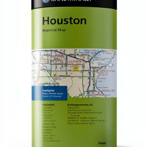
Rand McNally, a name synonymous with reliable cartography, presents a topographic map designed specifically for the modern adventurer. This map combines the precision of professional surveying with a user‑friendly layout, ensuring that every contour line, water feature, and elevation change is presented clearly. The compact format, measuring just 4 × 8.9 inches, makes it an ideal companion for backpacks, daypacks, and even pocket‑sized storage solutions.
The map is printed on a high‑grade, tear‑resistant paper that has been treated with a waterproof coating. This treatment protects the surface from rain, splashes, and accidental spills, allowing users to consult the map in wet conditions without fear of damage. The coating also adds a subtle matte finish that reduces glare, improving readability under bright sunlight.
Despite its small footprint, the map offers a surprisingly generous amount of detail. Each square inch contains carefully plotted contour intervals, trail markers, campsite locations, and points of interest such as water sources and scenic overlooks. The map’s scale has been calibrated to provide accurate distance measurements, enabling hikers to plan daily mileage and estimate travel times with confidence.
Rand McNally sources its geographic data from a combination of satellite imagery, aerial surveys, and on‑the‑ground verification by experienced field cartographers. This multi‑layered approach ensures that the topographic information reflects the most current terrain features, including recent trail reroutes, newly established campgrounds, and updated road access points.
The product is packaged in a recyclable sleeve that includes a quick‑start guide, a legend key, and a QR code linking to an online version of the map for digital reference. The lightweight design—just 3.2 ounces—means the map adds minimal load to any expedition, while the durable construction guarantees longevity across multiple seasons.
Whether you are a seasoned backcountry explorer, a weekend hiker, or a family planning a camping trip, this map provides the essential geographic context needed to navigate safely and efficiently. Its clear typography, intuitive symbols, and robust construction make it a trusted tool for anyone who values accurate navigation and reliable information.
![[Product front view showing all components]](https://www.akvex.store/wp-content/uploads/2026/06/fb35c44d2e2441c18967e2f40456536a.jpg)
Usage
The Rand McNally Topographic Map excels in a variety of outdoor settings. In mountainous regions, the detailed contour lines help users assess elevation gain and select routes that match their fitness level. For desert treks, the map highlights oasis locations, seasonal water sources, and terrain features that can affect navigation, such as sand dunes and rocky outcrops.
Backpackers embarking on multi‑day hikes will appreciate the map’s compact size, which fits neatly into a side pocket of a trekking pack. The waterproof coating ensures that the map remains legible after crossing streams or enduring unexpected rain showers. Campers can spread the map on a flat surface at the campsite to plan evening walks, locate nearby fire pits, and identify safe routes back to the trailhead.
Day hikers who prefer a lightweight approach can fold the map into a small envelope and carry it alongside a compass and a lightweight GPS device. The map’s clear symbols make it easy to cross‑reference with digital navigation tools, providing a reliable backup in case of battery failure or signal loss.
In educational settings, teachers can use the map to teach students about topography, watershed management, and the importance of accurate navigation. The map’s readability and comprehensive legend make it an excellent visual aid for classroom lessons and field trips.
Why Choose Us
Choosing the Rand McNally Topographic Map means investing in a product backed by over a century of cartographic expertise. Our commitment to quality starts with rigorous data verification, ensuring that every line and symbol reflects real‑world conditions. This dedication reduces the risk of navigation errors and enhances overall safety for users.
Our maps are manufactured in facilities that adhere to strict environmental standards. The paper is sourced from sustainably managed forests, and the waterproof coating is applied using low‑impact processes. By selecting this map, you support responsible production practices that protect the very environments you explore.
Customer support is a cornerstone of the Rand McNally experience. Our dedicated team is available to answer questions about map usage, provide clarification on symbols, and assist with any concerns regarding product durability. We also offer a satisfaction guarantee, allowing you to return the map within 30 days if it does not meet your expectations.
Beyond the physical product, we provide ongoing digital resources. The QR code on the packaging links to an online portal where you can download an updated PDF version of the map, access seasonal trail reports, and connect with a community of fellow hikers who share tips and route recommendations.
Key Features
- Waterproof coating protects the map from rain, splashes, and accidental spills, ensuring readability in all weather conditions.
- Compact 4 × 8.9 inch size and lightweight 3.2 ounce weight make it easy to carry in any backpack or pocket.
- High‑resolution topographic detail includes contour intervals, trail markers, campsite locations, and water source indicators for precise navigation.
- Accurate, up‑to‑date geographic data sourced from satellite imagery, aerial surveys, and field verification for reliable terrain representation.
- Dedicated customer support and a satisfaction guarantee provide peace of mind and assistance whenever you need it.
FAQ
Is the map suitable for use in extreme weather conditions?
Yes, the map’s waterproof coating is designed to withstand heavy rain, snow, and high humidity. The paper itself is tear‑resistant, and the ink is UV‑stable, so the map remains legible even after prolonged exposure to sunlight and moisture.
Can I use this map with a GPS device?
Absolutely. The map includes a clear grid system that aligns with standard GPS coordinate formats. You can overlay the printed map with digital GPS data, making it a reliable backup when electronic devices lose signal or battery power.
What is the scale of the map and how accurate are the distance measurements?
The map is printed at a 1:24,000 scale, which is a common standard for detailed topographic maps. This scale provides accurate distance measurements to within a few meters, allowing you to plan routes, estimate travel times, and gauge elevation changes with confidence.
How often is the map updated?
Rand McNally releases updates annually. The July 2022 edition reflects the most recent trail modifications, campsite additions, and road changes. Users can access the latest digital version via the QR code on the packaging, ensuring they always have the most current information.
What kind of customer support is available if I have questions about the map?
Our customer support team is available via phone, email, and live chat. They can help you interpret symbols, understand the legend, and provide advice on optimal map usage for specific environments. Additionally, we offer a 30‑day satisfaction guarantee for returns or exchanges.
Reviews
There are no reviews yet.