

Description
Product Overview
Delorme’s Atlas & Gazetteer for Missouri is a meticulously crafted topographic map that combines the precision of modern cartography with the durability required for rugged outdoor use. Updated for the 2024 edition, this map includes 72 pages of finely detailed terrain information, contour lines, water features, road networks, and trail markings that cover the entire state from the Ozark foothills to the Mississippi River floodplain. The map is printed on high‑quality, tear‑resistant paper that holds up against the elements, while the compact dimensions of 10.47 × 15.35 in make it easy to slip into a backpack, daypack, or pocket‑sized holder.
Each page is organized to provide a clear view of specific regions, allowing users to zoom in on local features without losing the broader context of surrounding areas. The atlas includes a comprehensive index, a legend that explains symbols for campsites, picnic areas, and points of interest, and a set of inset maps that highlight popular recreation zones such as the Mark Twain National Forest, the Katy Trail, and the Lake of the Ozarks. The inclusion of both metric and imperial units ensures that users from any background can interpret distances and elevations accurately.
Beyond its functional attributes, the Atlas & Gazetteer reflects Delorme’s long‑standing commitment to cartographic excellence. The company’s expertise, built over decades of producing reliable navigation tools for outdoor enthusiasts, is evident in the map’s attention to detail, from the precise placement of contour intervals to the inclusion of seasonal information about water levels and trail conditions. The product’s weight of just 14.1 oz means it adds minimal load to any expedition, while the sturdy binding resists wear from frequent handling.
Designed for a wide audience, the map serves hikers seeking day‑trip routes, backpackers planning multi‑day treks, cyclists exploring scenic byways, and even off‑road vehicle owners needing reliable guidance through remote backcountry roads. Its clear, legible typography and color‑coded symbols make it accessible for beginners while still offering the depth of information that seasoned explorers demand. Whether you are navigating the rolling hills of the Ozarks, planning a fishing trip along the Missouri River, or charting a historic road trip across the state’s cultural landmarks, this atlas provides the confidence and clarity needed for successful navigation.
In addition to its practical applications, the Atlas & Gazetteer serves as an educational resource, offering insights into the geological history, flora, and fauna of Missouri. The map’s detailed topography reveals the subtle changes in elevation that shape local ecosystems, while inset sections highlight protected areas, wildlife corridors, and historic sites. This dual purpose of navigation and education makes the atlas a valuable addition to any outdoor library, encouraging users to explore responsibly and appreciate the natural and cultural heritage of the region.
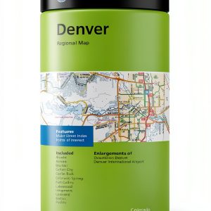
![[Product front view showing all components]](https://www.akvex.store/wp-content/uploads/2026/07/5d6a0331ad8642bbbb1164a7a7795f23.jpg)
Usage
The Atlas & Gazetteer is designed for real‑world outdoor scenarios, making it an indispensable companion on a variety of adventures. For hikers, the map’s detailed trail markings and elevation profiles enable precise planning of ascent and descent routes, helping to manage energy expenditure and time on the trail. Backpackers can use the index to locate water sources, campsites, and emergency exit points, ensuring safety during extended trips in remote wilderness areas.
Cyclists benefit from the map’s clear road classifications and bike‑friendly trail routes, allowing them to chart scenic rides that avoid high‑traffic highways while showcasing the state’s natural beauty. Off‑road vehicle enthusiasts will appreciate the inclusion of backcountry road networks, unpaved paths, and seasonal accessibility notes, which are essential for navigating challenging terrain without getting stranded.
Family campers can rely on the map’s campground listings, picnic area locations, and nearby attractions to plan enjoyable outings that combine recreation with relaxation. The atlas also serves as a valuable tool for educators and researchers conducting field studies, providing a reliable reference for locating study sites, tracking wildlife movements, and documenting environmental changes over time.
In emergency situations, the map’s clear symbols for rescue stations, medical facilities, and evacuation routes can be lifesaving. Its durable construction ensures that even if electronic devices fail or lose battery power, users still have a dependable paper reference to guide them back to safety. The Atlas & Gazetteer’s versatility makes it suitable for day trips, multi‑day expeditions, and even long‑term expeditions that require a comprehensive, always‑available navigation aid.
Why Choose Us
Choosing the Delorme Atlas & Gazetteer means selecting a product backed by a legacy of cartographic innovation and a reputation for reliability. Delorme’s rigorous quality control processes ensure that every map meets exacting standards for accuracy, durability, and readability. The company’s commitment to continuous improvement is reflected in the 2024 edition, which incorporates the latest satellite data, road updates, and trail revisions to provide the most current information available.
Our maps are printed on premium, water‑resistant paper that resists tearing, smudging, and fading, even when exposed to harsh weather conditions. The binding is reinforced to withstand frequent opening and closing, making the atlas a long‑lasting companion for countless adventures. Additionally, the map’s design prioritizes user experience, with a clean layout, intuitive legend, and color‑coded symbols that reduce visual clutter and enhance quick decision‑making in the field.
Delorme also offers exceptional customer support, including a dedicated helpline and online resources that provide assistance with map interpretation, route planning, and troubleshooting. Should you encounter any issues with your atlas, our responsive service team is ready to help, ensuring that you can focus on your outdoor pursuits without worry. This level of after‑sales care underscores our commitment to customer satisfaction and product excellence.
Environmental stewardship is another cornerstone of our brand. The Atlas & Gazetteer is produced using sustainable printing practices, with inks that meet low‑VOC standards and paper sourced from responsibly managed forests. By choosing our map, you support eco‑friendly manufacturing while enjoying a product that respects the natural environments it helps you explore.
Finally, the Atlas & Gazetteer’s high customer rating—averaging 4.9 out of 5 stars from over 50 reviews—demonstrates the trust and appreciation of the outdoor community. Users consistently praise its accuracy, durability, and ease of use, making it a top‑ranked choice in the competitive market of topographic maps. When you select this atlas, you are investing in a proven, high‑quality tool that enhances every outdoor experience.
Key Features
- 72 pages of detailed, up‑to‑date topographic information for the entire state of Missouri.
- Lightweight 14.1 oz construction with tear‑resistant paper for durability in harsh conditions.
- Compact 10.47 × 15.35 in size that fits easily into backpacks, daypacks, or pocket holders.
- Clear legend and color‑coded symbols that simplify navigation for beginners and experts alike.
- Responsive customer support and sustainable printing practices for peace of mind and environmental responsibility.
FAQ
What makes the 2024 edition different from previous versions?
The 2024 edition incorporates the latest satellite imagery, road updates, and trail revisions, ensuring that users have the most current information available. It also includes new inset maps highlighting emerging recreation areas and updated symbols for recent campground developments.
Is the map suitable for use in all weather conditions?
Yes, the Atlas & Gazetteer is printed on water‑resistant, tear‑resistant paper that holds up against rain, humidity, and temperature fluctuations. The binding is reinforced to prevent pages from separating, making it reliable in both dry and wet environments.
Can I use this map for off‑road vehicle navigation?
Absolutely. The map features detailed backcountry road networks, unpaved trail routes, and seasonal accessibility notes that are essential for off‑road enthusiasts. It also marks points of interest such as fuel stations, repair shops, and emergency services.
How does the map help with emergency preparedness?
The atlas includes clearly marked rescue stations, medical facilities, and evacuation routes. Its durable construction ensures that it remains usable even if electronic devices fail, providing a reliable paper backup for critical navigation during emergencies.
What support does Delorme offer after purchase?
Delorme provides a dedicated customer helpline, online tutorials, and a comprehensive FAQ database to assist users with map interpretation, route planning, and any issues that may arise. Our responsive support team is committed to ensuring a positive experience throughout the product’s lifespan.
Reviews
There are no reviews yet.